Riding is what we want to do. Messing around with maps is not. How do you plan a route? How do you follow it? This has been an issue for me since I started riding. As a result, when I ride alone I just pick a direction and go. If the road changes, so does my route. The direction I start out may be nothing like where I end up. If I’m riding alone that’s fine. If I’m riding with others that expect me to know where I’m going that doesn’t exactly work out. I need to have a route in mind and know where my turns are and how to get to the right destination.
I have a Navigator V on my RT. I’m not very fond of it. I much prefer my phone and Google maps. But Google maps has drawbacks. It works great when you have a co-pilot or navigator with fingers not keeping the bike under control. Sure, you can plot out the route and save it on your phone, to a point. Google maps has a restriction on how many way-points are allowed. That’s a big restriction. Another is Google Maps has no “hard surface roads only” option. There is nothing like running down a road only to be dumped off on gravel at 55 miles per hour. Yes, I know. You GS guys live for exactly that thrill. Anyway, that makes me throw Google maps out the window.
I can use Garmin Base Camp to plot my routes. It is a good product and has lots of options. LOT’s of options. I’ve designed software and programs for years. I’ve learned dozens of programs supplied by vendors and companies. Rule number one is to design an application that can be learned and figured out without an advanced engineering degree. Needless to say. Garmin Base Camp just went out the window right behind Google maps. It takes way too much time to understand and become comfortable with it.
What do I really want and what features do I need? OK. So I have a very short list of requirements for a route planning application.
1) It must be easy to learn and use.
2) Specify start point, destination point and any number of way points. Also, it should be easy to move or extend the destination.
3) Save the route and export the route as a .GPX file so I can import it into the Navigator V and run the route.
4) Last, and very important, it has to be FREE.
It’s that simple. I want to plot my route and push it into my GPS so I can follow it on my bike without looking at a paper list, paper map or messing with my phone. All of these are actions that take my vision away from the road. Not a good safety practice.
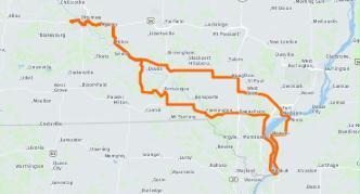
I’ve tested many route planners. There are a LOT of them. They are either too complex, don’t allow for export and import to your GPS, have limited way-points or have a cost associated with them. Then I had a recommendation from a fellow rider. Check out Harley Davidson. WHAT??? Really? Yes. HD (https://maps.harley-davidson.com) has the simplest application that meets all my requirements. It does require a sign-on ID but there is no fee. I opened the app and within ten minutes I had planned out a route, added way-points to specify roads, saved the route to my account and exported the .GPX file. There is even an option to show and require only hard surfaced roads. There is a mobile app and a desktop app. It’s easier to plan on the desktop application. Say what you want about Harley Davidson bikes but their route planner had to have been written by people that actually ride bikes. For that, they get a lot of credit from me. Give it a try.
Nice article! Thank you.
I check harley davidson’s map on the link but your route plan seems more safe.